

Village map of Landal Camping De Zandput
Up-to-date and comprehensive village map of Landal Camping De Zandput with all accommodations and facilities, also available as PDF.
Click on the image for a larger version.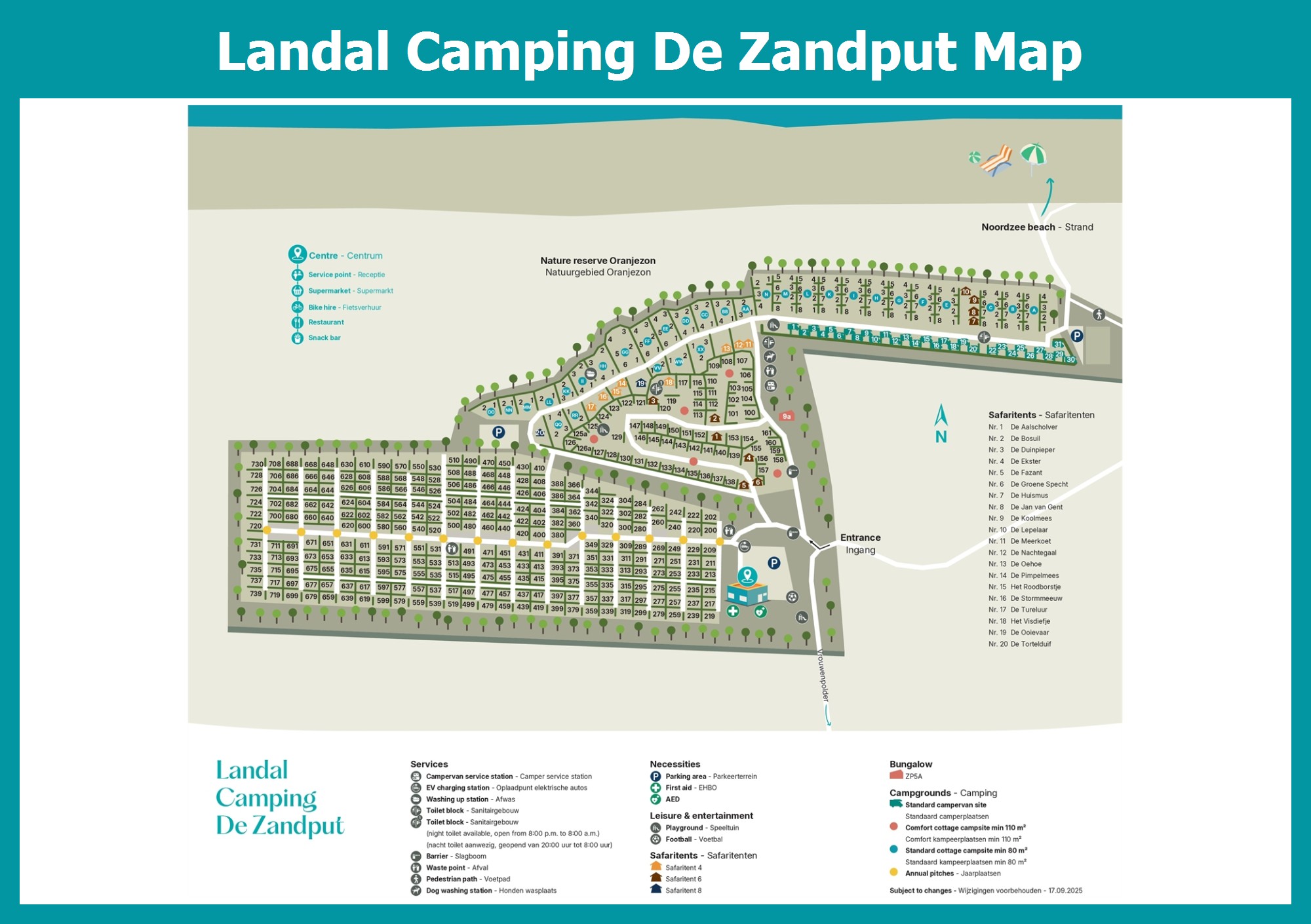

Map Camping De Zandput
Village map of Landal Camping De Zandput, also available as PDF.
Landal Camping De Zandput
The adventure begins the moment you leave the highway. From the family-friendly Vrouwenpolder, you drive on charming country roads and over dikes towards the dunes. Nestled in the dunes is our family campsite, De Zandput, where sand was once collected. In the past, fresh water was also drawn from the dunes. This old 'water extraction area' is now a peaceful and beautiful spot right next to the campsite.
No matter which way you leave the campsite, you are heading into adventure or nature: the North Sea beach, the towns and villages on Walcheren island, the Veerse lake, or the walking and biking paths along dikes, through forests, or across open fields. The beaches at Vrouwenpolder have a Blue Flag, which is a European mark of cleanliness and safety for marinas and beaches.